
Geospatial analytics refers to endowing data with a location component. It also applies to concepts such as business intelligence and location analytics. Companies store a lot of data, including data about employees, customers, transactions, etc., which are usually associated with physical space. There are lots of benefits of using geospatial data in analytics for your business. Spatial components enhance data to enable you to learn more about new opportunities, business success, growth, and customers. It is another way to transform business through innovation.
What is Geospatial Data?
Geospatial data is data about objects and phenomena located in a specific place on the earth’s surface. Using this data, you can get information about roads and various things of urban infrastructure, natural disasters, including earthquake, and children living in poverty. At the same time, it is essential to note that large volumes of geospatial data are in the public domain, and any user, if desired, can get them for free. This data provides information about settlements, roads, and other public facilities. All this works for geospatial data analysis as well.
click here – How to Get A Temporary Vehicle Registration for Your Four-Wheeler
What is Geospatial Analytics?
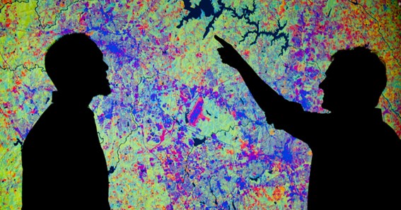
Geospatial analytics uses location sensors, GPS data, satellite imagery, and social media to visualize data and reveal trends in the relationships between people and places. Geo-referenced data applies to most events on our planet. Visualization can be presented in a graph, map, statistics, and other documents showing what changes have already occurred and what is happening at the moment. It significantly improves the accuracy of forecasts.
Geospatial data analysis of images is an essential type of geospatial analytics. This type of analytics provides the ability to obtain video data and images of the planet, which are used to identify potential risks and draw up contingency plans. In particular, meteorologists use data to identify tornadoes and calculate their trajectory. In agriculture, geospatial analytics also brings many benefits. For example, using the obtained data, you can manage vegetation and evaluate the moisture content of the soil, water, and much more.
Geospatial analytics allows you to instantly process vast amounts of data, including geometric and geographic data, so that users can interact with points on the map and observe geospatial visualizations in real-time. In this way, you can see how objects change over time and assess the scale of these changes. Visit https://eos.com/ to learn more about the benefits of geospatial analytics across industries.
click here – Digital Solutions For Successful Weight Management and Obesity Prevention
How Can Geospatial Analytics Benefit Your Business?
With geospatial analytics and spatial business intelligence, you can empower your customers. You can use visualization to facilitate relationships with a client in a virtual space. In addition, it is an opportunity for businesses to improve forecasting, predictive analytics, and marketing.
Qualitative analytics allows you to plan and solve problems using unique information. The data sets also hide patterns and trends that will help you improve your customer experience. The results obtained with the help of geospatial analysis contribute to the establishment of communication between companies and customers. A meaningful advantage is also the ability to minimize the consequences of various incidents, including forest fires, as well as track supply chains, the spread of diseases, direct and manage multiple social and economic initiatives.
Future of Geospatial data
Most experts believe that geospatial technologies will continue to evolve and become more functional and complex. It is mainly driven by interactions with other innovative technologies such as artificial intelligence and machine learning. It is also expected that geospatial AI will interact with machine learning, bringing a geographical element.
According to experts, the mapping will also become a service that will allow you to create customized high-resolution maps to meet the requirements of manufacturers and consumers fully. The development of new vehicles largely depends on the development of geospatial technologies. Autonomous vehicles and drones will be used more frequently. In addition, these technologies are also expected to be used for other purposes, including the use of drones for aerial photography.
To Know Some Great Stuff Do Visit MesBrand
To Know Some Great Stuff Do Visit NeoAuthors
To Know Some Great Stuff Do Visit OfsType